
124 Summary — Physical Geology – 2nd Edition
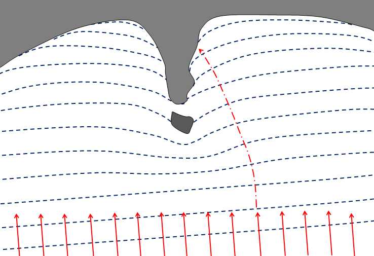
Figure A
- Explain the origins of a wave-cut platform.
- How do we define the limits of the beach face, and what are some other terms used to describe this zone?
- A spit is really just a beach that is only attached to the shore at one end. What conditions are necessary for the formation of a spit?
- Barrier islands are common along the Atlantic coast of the U.S. as far north as Massachusetts. Why are there almost none in the northeastern U.S.?
- Figure B represents an island on the central coast of B.C. that has experienced 140 m of isostatic rebound since deglaciation, and has also been affected by the global eustatic sea-level rise over the same period. The dashed line marks sea level during glaciation. How much higher or lower should that line be now?
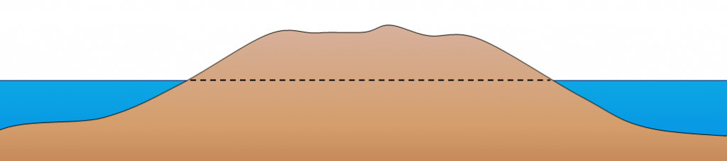 Figure B
 - If a dam were to be built on the Fraser River near Hope, what would be the long-term implications for beaches in the Vancouver area? Explain why.
Media Attributions
- Figure A, B: © Steven Earle. CC BY.