54 6.5 Groups, Formations, and Members — Physical Geology – 2nd Edition
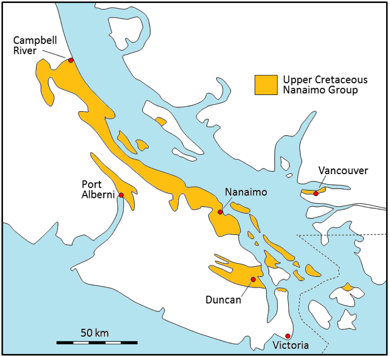
The sedimentary rocks of the Nanaimo Group provide a useful example for understanding groups, formations, and members. During the latter part of the Cretaceous Period, from about 90 Ma to 65 Ma, a thick sequence of clastic rocks was deposited in a foreland basin between what is now Vancouver Island and the B.C. mainland (Figure 6.5.1). The Nanaimo Group strata comprise a 5000-metre-thick sequence of conglomerate, sandstone, and mudstone layers. Coal was mined from Nanaimo Group rocks from around 1850 to 1950 in the Nanaimo region, and even more recently in the Campbell River area.
| [Skip Table 6.6] | |||
| Approximate Age (Ma) | Formation name | Lithologies | Depositional Environment |
|---|---|---|---|
| 65 to 66 | Gabriola | Sandstone with minor mudstone | Submarine fan, high energy |
| 66 to 67 | Spray (Fine grained) | Mudstone/sandstone turbidites | Submarine fan, low energy |
| 67 to 68 | Geoffrey | Sandstone and conglomerate | Submarine fan, high energy |
| 68 to 70 | Northumberland (Fine grained) | Mudstone turbidites | Submarine fan, low energy |
| 70 | De Courcy | Sandstone | Submarine fan, high energy |
| 70 to 72 | Cedar District (Fine grained) | Mudstone turbidites | Submarine fan, low energy |
| 72 to 75 | Protection | Sandstone and minor coal | Nearshore marine and onshore deltaic and fluvial |
| 75 to 80 | Pender | Sandstone and minor coal | Nearshore marine and onshore deltaic and fluvial |
| 80 | Extension | Conglomerate, with minor sandstone and some coal | Nearshore marine and onshore deltaic and fluvial |
| 80 to 85 | Haslam (Fine grained) | Mudstone and siltstone | Shallow marine |
| 85 to 90 | Comox | Conglomerate, sandstone, mudstone (coal in the Campbell River area) | Nearshore fluvial and marine |
The five lower formations of the Nanaimo Group are all exposed in the Nanaimo area, and were well studied during the coal mining era between 1850 and 1950. All of these formations (except Haslam) have been divided into members, as that was useful for understanding the rocks in the areas where coal mining was taking place. Within some of those members even some individual beds have been named if they were of specific importance to the mining industry.
Although there is a great deal of variety in the Nanaimo Group rocks, and it would take hundreds of photographs to illustrate all of the different types of rocks, a few representative examples are provided in Figure 6.5.2.
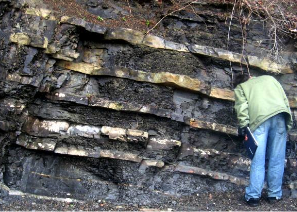
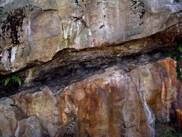
Figure 6.5.1 image description: A map showing that Nanaimo Group rocks are present along the east coast of Vancouver Island from Nanaimo to Campbell River, farther inland in areas around Port Alberni and Duncan, on much of the Gulf Islands and a bit in the Vancouver area. [Return to Figure 6.5.1]
Media Attributions
- Figure 6.5.1: Redrawn based on Mustard, P., 1994, The Upper Cretaceous Nanaimo Group, Georgia Basin, in J. Monger (ed) Geology and Geological Hazards of the Vancouver Region, Geol. Survey of Canada, Bull. 481, pp. 27-95. © Steven Earle. CC BY.
- Figure 6.5.2abc: © Steven Earle. CC BY.
- [Based on data in Mustard, P., 1994, The Upper Cretaceous Nanaimo Group, Georgia Basin, in J. Monger (ed) Geology and Geological Hazards of the Vancouver Region, Geol. Survey of Canada, Bull. 481, p. 27-95.] ↵
<!– pb_fixme –>
<!– pb_fixme –>
