96 12.4 Measuring Geological Structures — Physical Geology – 2nd Edition
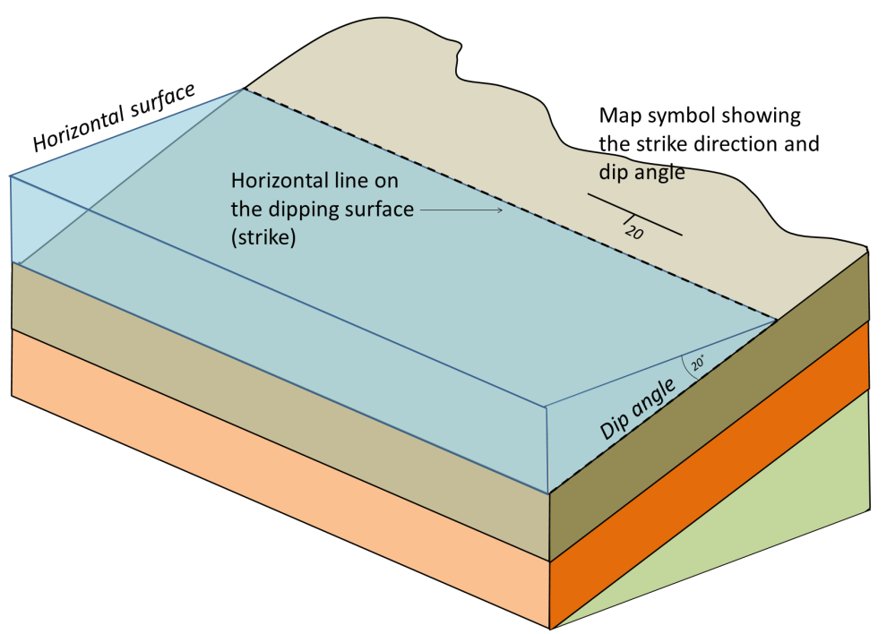
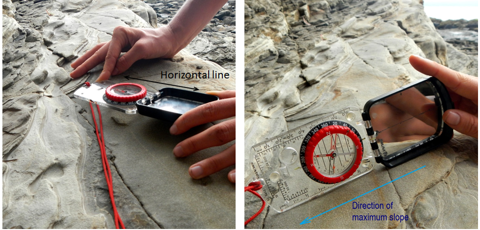
Measurement of geological features is done with a special compass that has a built-in clinometer—a device for measuring vertical angles. An example of how this is done is shown on Figure 12.4.2.
Strike and dip are also used to describe any other planar features, including joints, faults, dykes, sills, and even the foliation planes in metamorphic rocks. Figure 12.4.3 shows an example of how we would depict the beds that make up an anticline on a map.
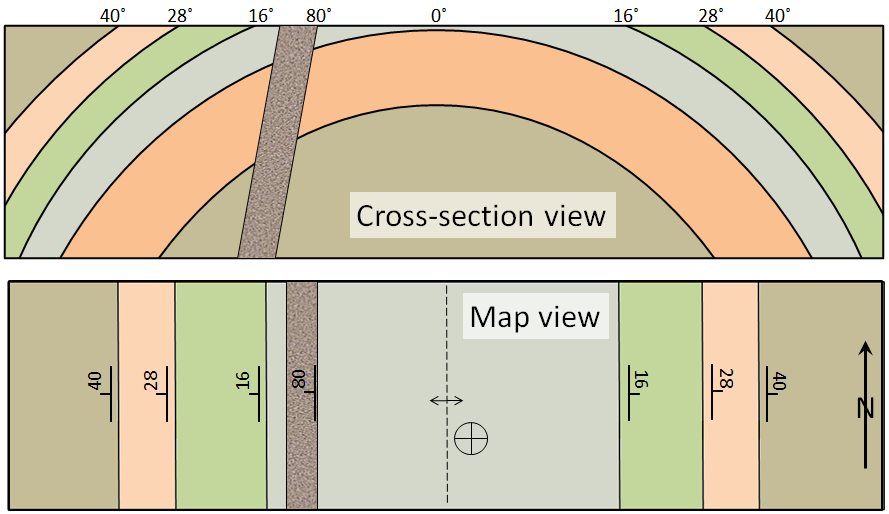
The beds on the west (left) side of the map are dipping at various angles to the west. The beds on the east side are dipping to the east. The middle bed (light grey) is horizontal; this is denoted by a cross within a circle. The dyke is dipping at 80˚ to the west. The hinge of the fold is denoted with a dashed line with two arrows that point away from it. If it was a synform, the arrows would point towards the line.
This cross-section shows seven tilted sedimentary layers (a to g), a fault, and a steeply dipping dyke. Place strike and dip symbols on the map to indicate the orientations of the beds shown, the fault, and the dyke. Then answer the questions.
- What type of fault is this, and is this an extensional or compressional situation?
- What are the relative ages of the nine geological features shown here (seven beds, dyke, and fault)? Which are the youngest and oldest?
See Appendix 3 for Exercise 12.3 answers.
Media Attributions
- Figures 12.4.1, 12.4.2, 12.4.3, 12.4.4: © Steven Earle. CC BY.
<!– pb_fixme –>
<!– pb_fixme –>
