96 13.2 Drainage Basins — Physical Geology – 2nd Edition
A stream is a body of flowing surface water of any size, ranging from a tiny trickle to a mighty river. The area from which the water flows to form a stream is known as its drainage basin. All of the precipitation (rain or snow) that falls within a drainage basin eventually flows into its stream, unless some of that water is able to cross into an adjacent drainage basin via groundwater flow. An example of a drainage basin is shown in Figure 13.2.1.

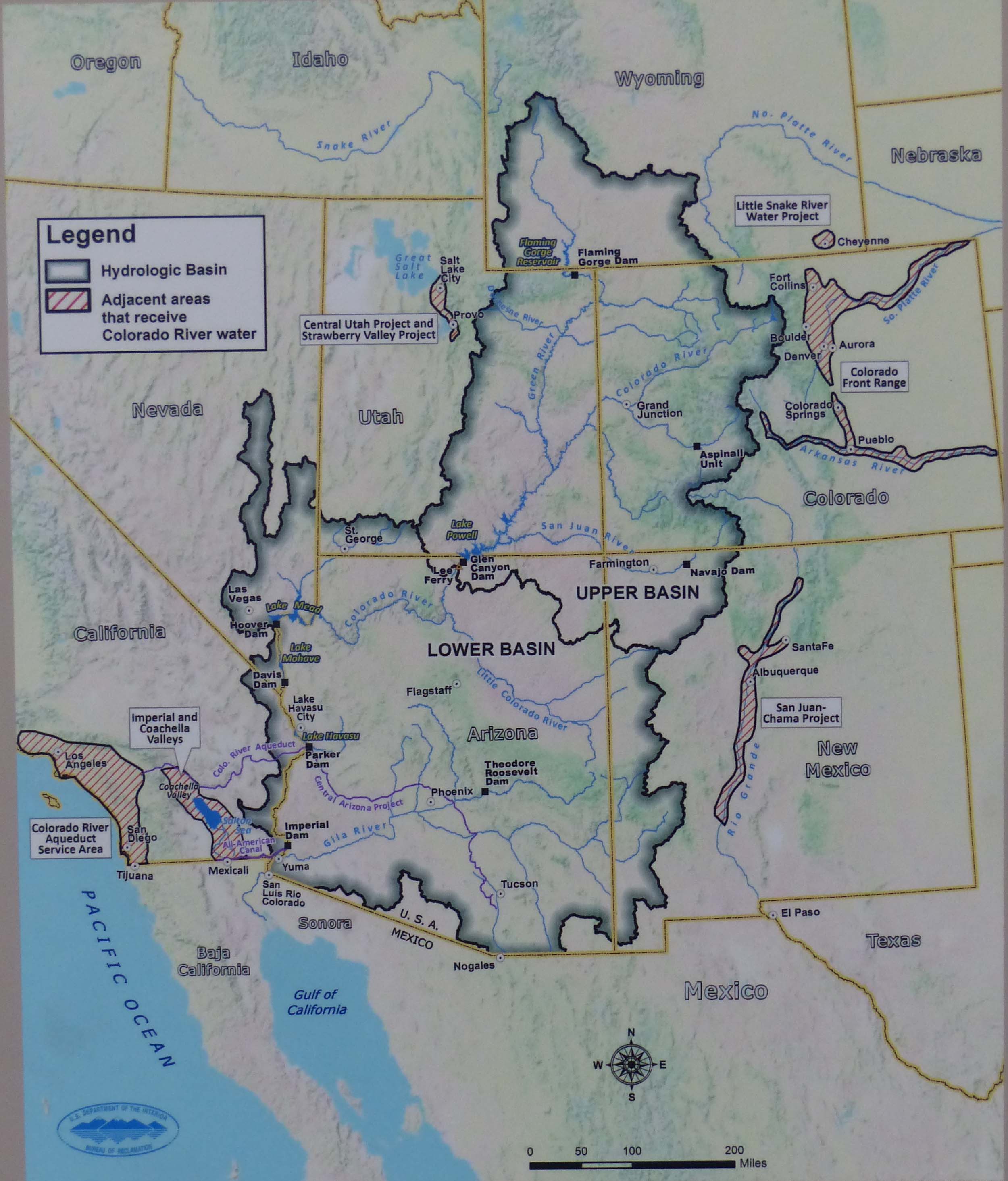
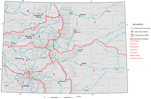
The state of Colorado’s water supply comes from seven large drainage basins. Nearly all of these basins are fed or controlled by the Rocky Mountains (Figure 13.2.3.). Over 80% of the state’s precipitation falls on the Western Slope, or west of the Continental Divide. Thus, it is not uncommon for communities along the Front Range Region to import water from the western portion of the state. Metropolitan Denver’s water supply comes from seven smaller drainage basins (Figure 13.2.4.), all of which occupy the larger South Platte Basin as displayed on Figure 13.2.3. For an area such as Denver, it is imperative to have not just one drainage basin to reliably suit its needs because one basin may receive very little precipitation recharge whereas the recharge in another nearby basin can be significantly high.

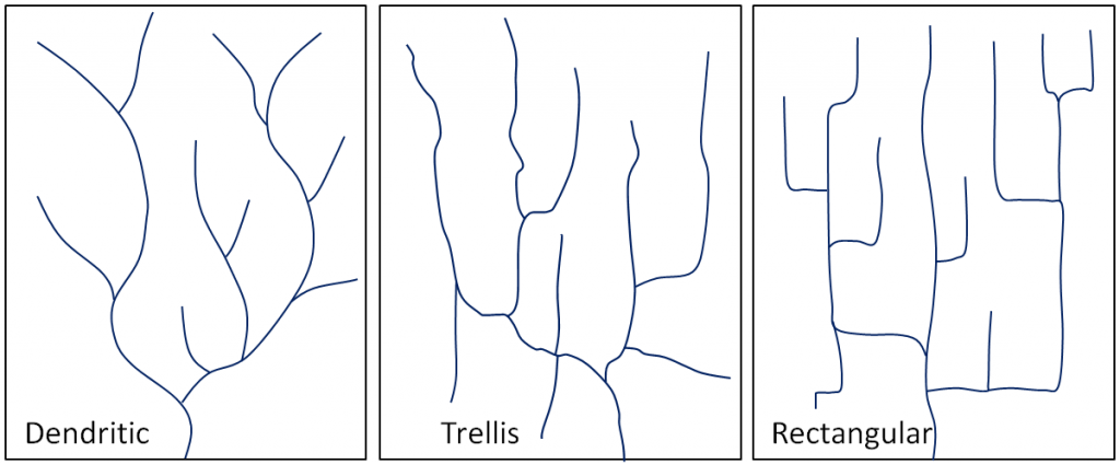
The pattern of tributaries within a drainage basin depends largely on the type of rock beneath, and on structures within that rock (folds, fractures, faults, etc.). The three main types of drainage patterns are illustrated in Figure 13.2.4. Dendritic patterns, which are by far the most common, develop in areas where the rock (or unconsolidated material) beneath the stream has no particular fabric or structure and can be eroded equally easily in all directions. Examples would be granite, gneiss, volcanic rock, and sedimentary rock that has not been folded. Trellis drainage patterns typically develop where sedimentary rocks have been folded or tilted and then eroded to varying degrees depending on their strength. The Rocky Mountains of are a good example of this, and many of the drainage systems within the Rockies have trellis patterns. Rectangular patterns develop in areas that have very little topography and a system of bedding planes, fractures, or faults that form a rectangular network.
A fourth type of drainage pattern, which is not specific to a drainage basin, is known as radial (Figure 13.2.6). Radial patterns form around isolated mountains (such as volcanoes) or hills, and the individual streams typically have dendritic drainage patterns.
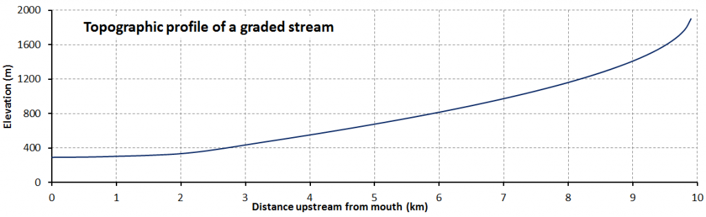
Over geological time, a stream will erode its drainage basin into a smooth profile similar to that shown in Figure 13.2.7. Here, we can see that graded streams are steepest in their headwaters and their gradient gradually decreases toward their mouths. Ungraded streams have steep sections at various points, and typically have rapids and waterfalls at numerous locations along their lengths. A graded stream can become ungraded if there is renewed tectonic uplift, or if there is a change in the base level, either because of tectonic uplift or some other reason. The ocean is the ultimate base level, but lakes and other rivers act as base levels for many smaller streams. We can create an artificial base level on a stream by constructing a dam, as illustrated in Exercise 13.2, and in Figure 13.2.8.
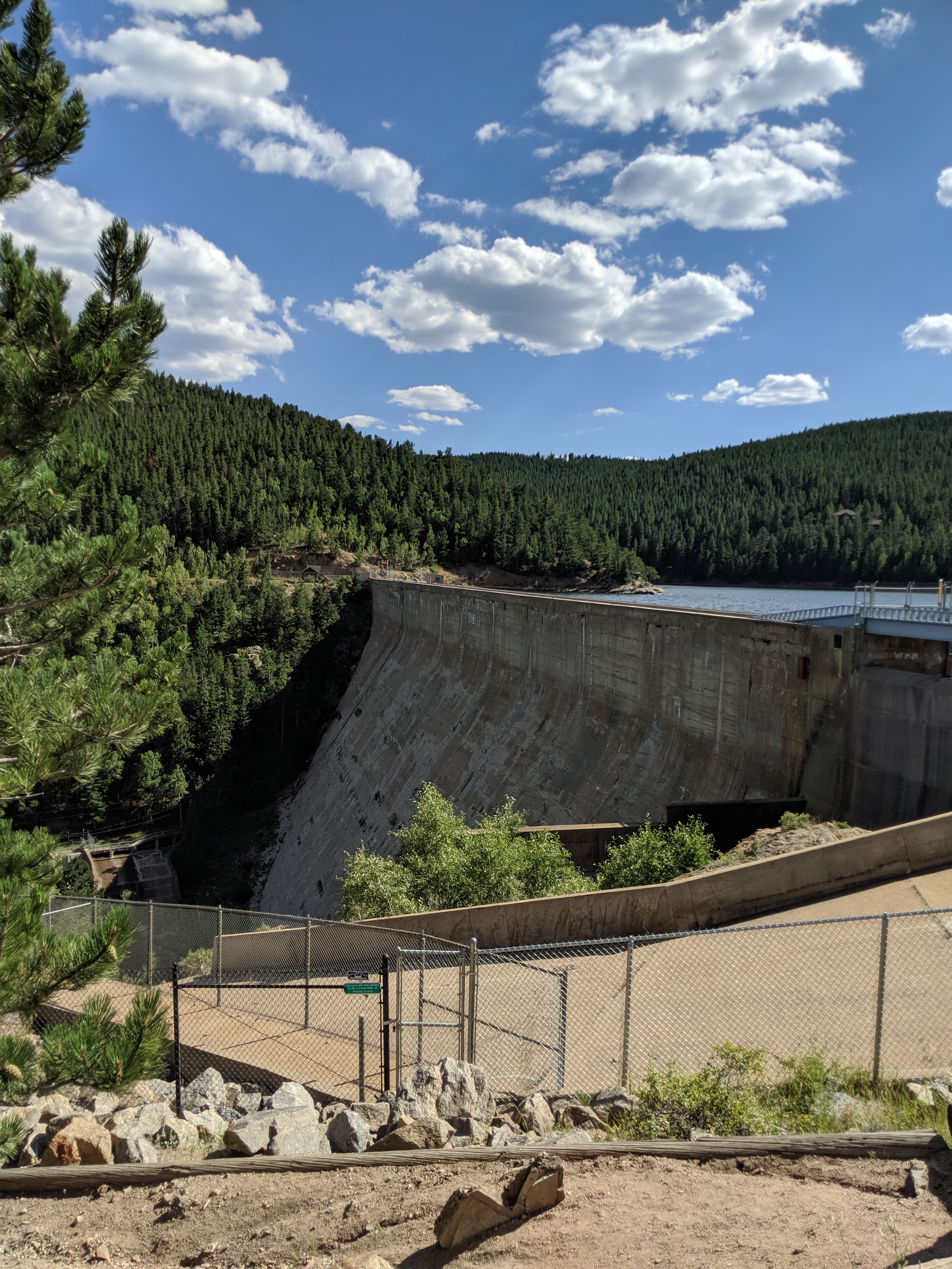
When a dam is built on a stream, a reservoir (artificial lake) forms behind the dam. This temporarily (for many decades at least) creates a new base level for the part of the stream above the reservoir.
How does the formation of a reservoir affect the stream where it enters the reservoir, and what happens to the sediment it was carrying?
The water leaving the dam has no sediment in it. How does this affect the stream below the dam?
See Appendix 3 for Exercise 13.2 answers.
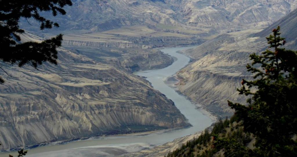
Sediments accumulate within the flood plain of a stream, and then, if the base level falls, or if there is less sediment to deposit, the stream may cut down through those existing sediments to form terraces. A terrace on the Fraser River, of British Columbia, is shown in Figure 13.2.9. Note how the river shows at least two levels of terraces.
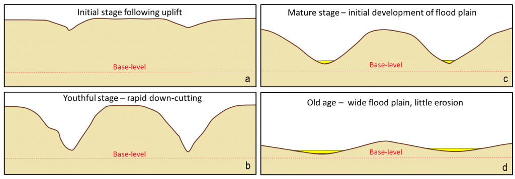
In the late 19th century, American geologist William Davis proposed that streams and the surrounding terrain develop in a cycle of erosion (Figure 13.2.10). Following tectonic uplift, streams erode quickly, developing deep V-shaped valleys that tend to follow relatively straight paths. Gradients are high, and profiles are ungraded. Rapids and waterfalls are common. During the mature stage, streams erode wider valleys and start to deposit thick sediment layers. Gradients are slowly reduced and grading increases. In old age, streams are surrounded by rolling hills, and they occupy wide sediment-filled valleys. Meandering patterns are common.
Davis’s work was done long before the idea of plate tectonics, and he was not familiar with the impacts of glacial erosion on streams and their environments. While some parts of his theory are out of date, it is still a useful way to understand streams and their evolution.
Media Attributions
- Figures 13.2.1: Wikimedia Commons
- 13.2.2: Andrew Darling, Colorado State University
- 13.2.3: Colorado Geological Survey
- 13.2.4: Denver Water
- 13.2.5, 13.2.6, 13.2.7, 13.2.9., 13.2.10.: © Steven Earle. CC BY.
- Figure 13.2.8.: Wikimedia Commons
